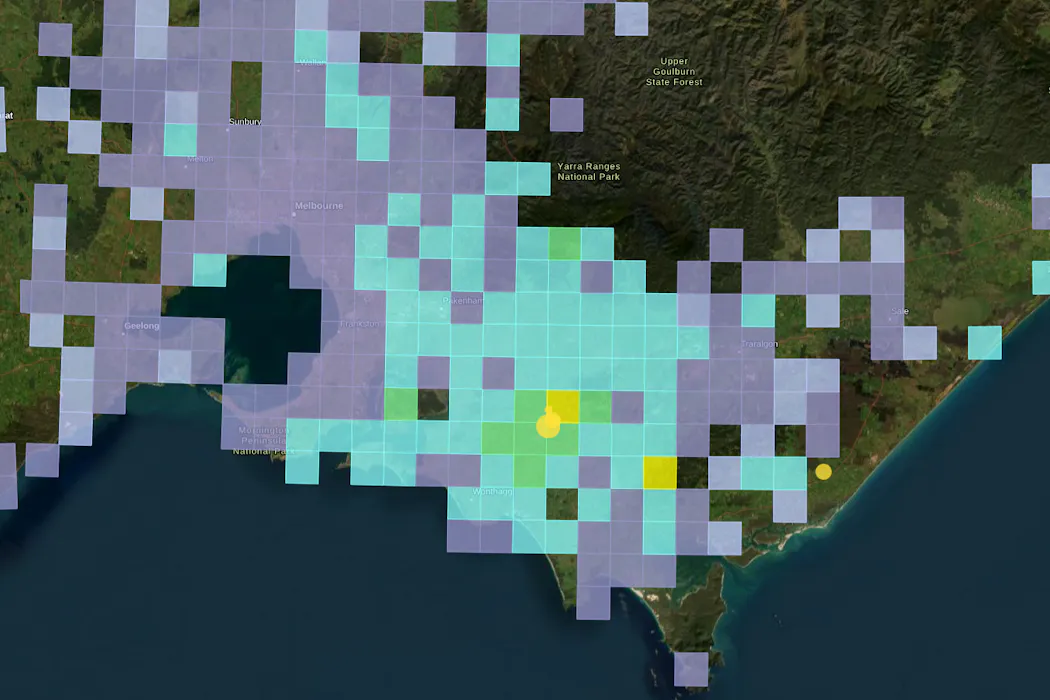
澳大利亚维多利亚州东南部周六凌晨2点刚过发生4.8级地震,震中位于Arawata地区,距离墨尔本东南约100公里1。地震引发了密集的余震活动,其中最大的余震达到3.1级,在主震后不到一小时内发生1。澳大利亚地球科学局(Geoscience Australia)在震后数小时内收到了超过21,000份震动报告1。
该地区频繁发生地震与其地质构造特征密切相关。吉普斯兰地区因新构造断层活跃,过去100年平均每十年发生一次相似规模或更大的地震事件1。历史上,该地区2012年曾发生5.4级地震1,规模相当于1989年造成13人死亡的纽卡斯尔地震1。地质证据表明,该地区的Waratah断层有可能产生约7.0级的地震1。
A magnitude 4.8 earthquake shook southeast Victoria early Saturday morning, with its epicenter near Arawata, approximately 100 kilometers southeast of Melbourne and 6 kilometers northeast of Korumburra 1. The initial tremor struck just after 2 a.m. and was followed by hundreds of aftershocks, the strongest measuring 3.1 in magnitude and occurring within an hour of the main event 1. Geoscience Australia received over 21,000 reports of ground shaking within hours of the earthquake 1.
The Gippsland region, where the earthquake occurred, sits on newly active tectonic faults that have historically produced significant seismic events 1. Over the past century, the area has experienced earthquakes of similar or greater magnitude approximately once per decade 1. A 2012 earthquake in Gippsland registered 5.4 in magnitude, equivalent in strength to the devastating 1989 Newcastle earthquake that killed 13 people 1. Geological evidence suggests the Waratah fault system in the region could potentially generate earthquakes reaching magnitude 7.0 1.
评论
还没有评论,欢迎留下第一条。